Packington Village History Group PVHG has joined with a major internet repository of Gravestone Photographic Records to host hundreds of images of Packington gravestones, with the details of over 460 names recorded on them. There are still more to be added, when time permits..
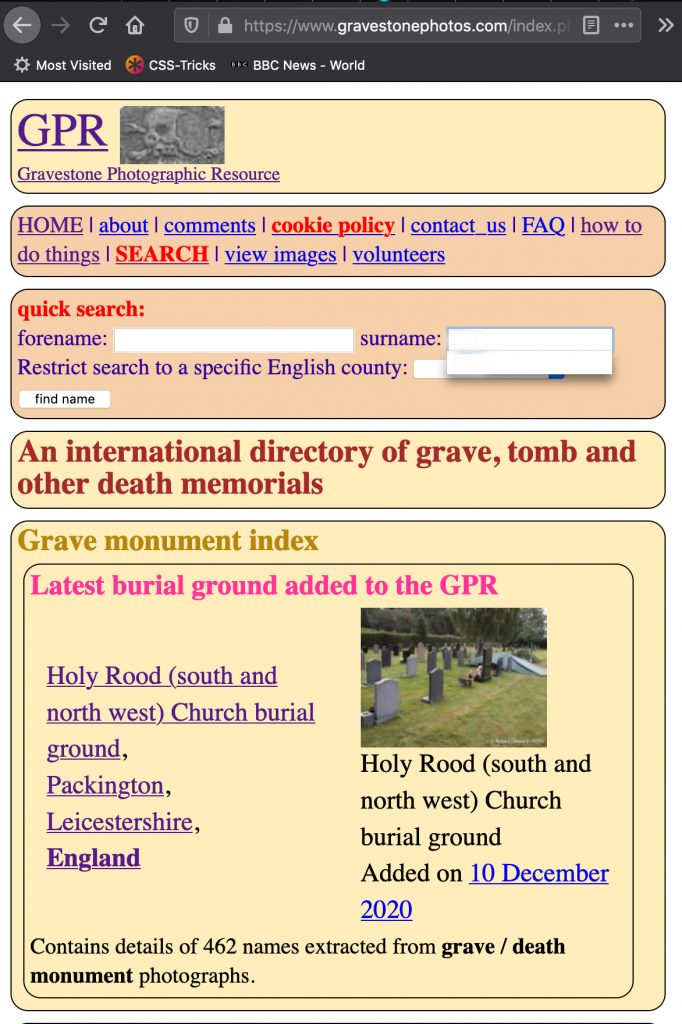
YOU can now access these records, using the Gravestone Photo Resource (GPR) website
Here’s what you’ll see:
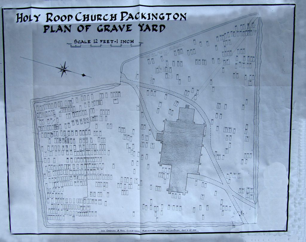
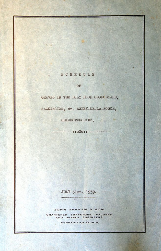
Records of burials have of course been kept in official registers, but after hundreds of years the first summary of the churchyard layout was produced on 31st July 1939 by surveyors, John German & Son of Ashby de la Zouch, our local town.
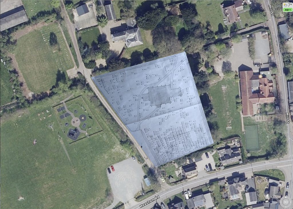
Note that this 1939 plan is NOT North-oriented. The next picture shows the 1939 layout super-imposed on a North-oriented village satellite map, courtesy of Apple Maps:
This 1939 layout plan accompanied a Plot List Schedule document in which 408 separate graves were identified:
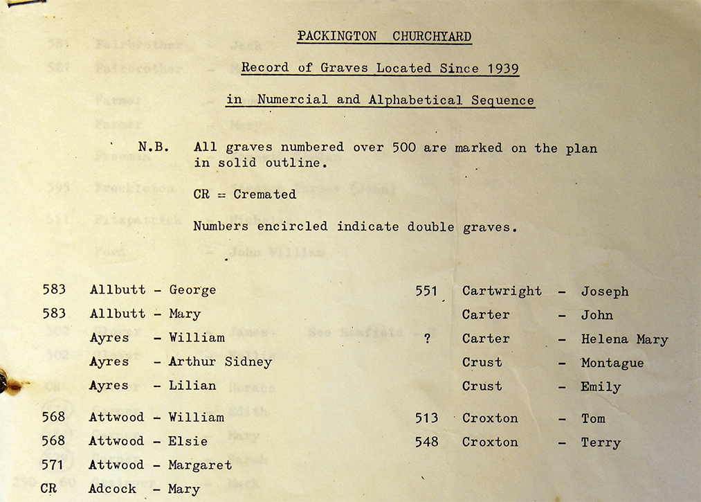
Sometime during the next 40 years, a further typewritten plot list of graves located since 1939 was produced, allocating new numbers in a series beginning 500 and 600. We’re not sure when this list was made – it seems it was before word-processors became common, so probably before 1990:
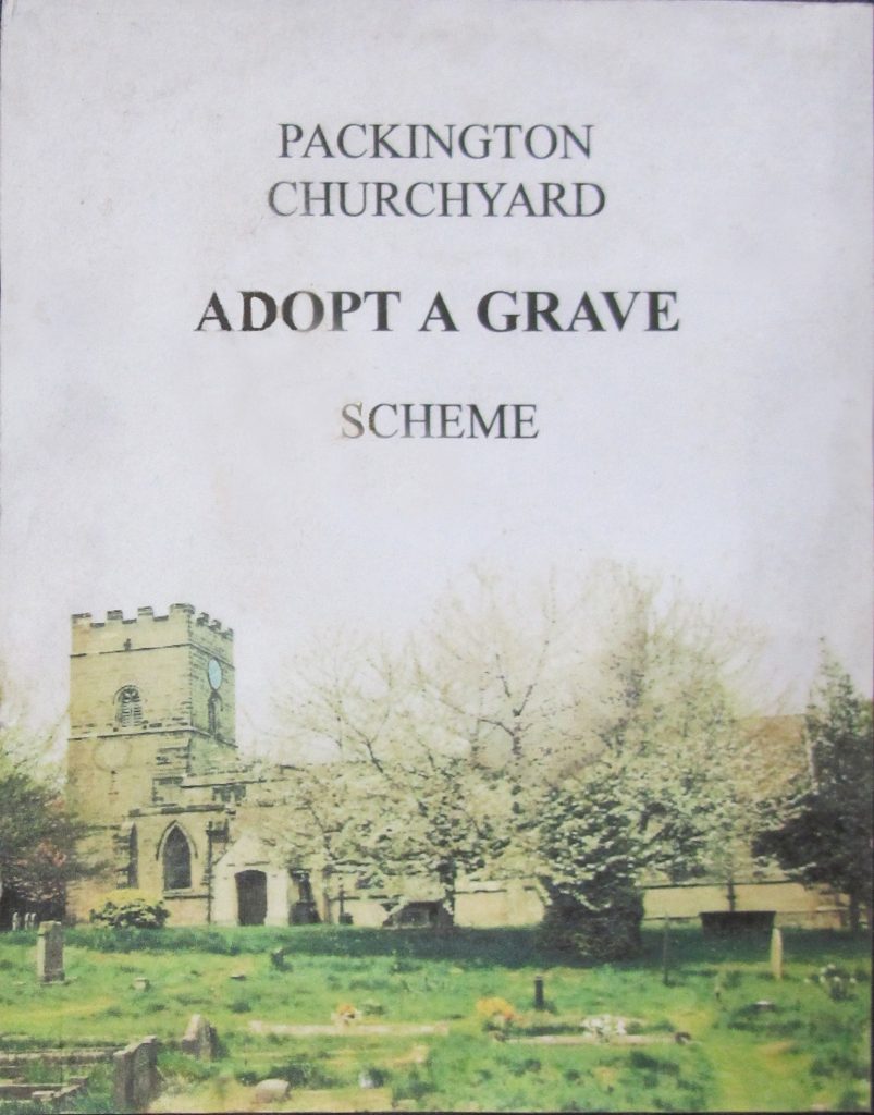
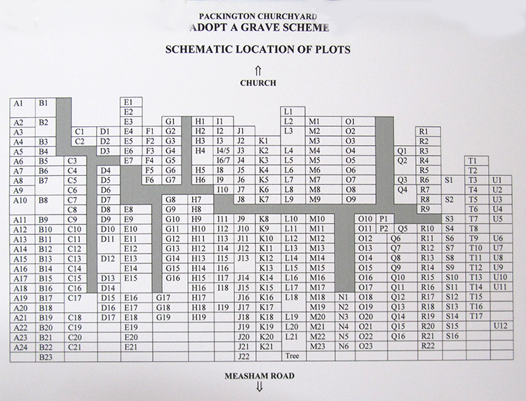
Sixty years after the pre-war 1939 plot list, in the early twenty-first century, a highly-detailed survey of the South Churchyard was carried out by village stalwarts Richard and Karen Roberts, and used to produce the 2002 “Adopt A Grave” Scheme. Graves deteriorating in the South churchyard could be adopted and maintained by individual churchgoers. Richard documented the memorial inscriptions on the head and side-stones of the graves in a comprehensive spreadsheet, numbering and giving the location of each recognisable grave there. The spreadsheet indexed the graves by
- plot number
- surname
- first name
- date of decease
There are more records to be published – in particular, a word-processed and photographed book-form inventory of many graves in the West and Central areas of the churchyard was produced in 2010 by PVHG Members David Fill and Paula Page.
The recent uplift to Gravestone Photo Resource GPR includes the 2002 Adopt A Grave spreadsheet details, with over two hundred photos of the South graveyard headstones, taken by PVHG members David Fill and Robert Dilworth during 2011.
At Packington Village History Group, PVHG, we aim to make our village history information available to the wider community. This graveyard documentation is an early project for the Dissemination policy of the group.
New members are always welcome at PVHG – even though our group is not at present meeting in 2020 or early 2021.
You are welcome to contact the group’s chair, Robin Boucher, by email to randbboucher at googlemail dot com